June continued with many bike rides as I tried to repair my sorry glute. Some of these rides allowed me to get more Trig points etc for the Covid trig challenge and in doing so to also explore places I had either never been to or had not visited in ages. I had a wonderful ride over Newton Fell and walked my bike places a bike should not be sensibly taken. The whizz down to Clitheroe made it very worth while. A trip south across flat lands then took me up Harrock Hill and I finally bit the bullet and did the cycle ride over the Trough. That is the Trough of Bowland and a magnet for northern cyclists.
I did it from the north clockwise and I am sure that is easier than the way I last did it on a mountain bike many years ago.
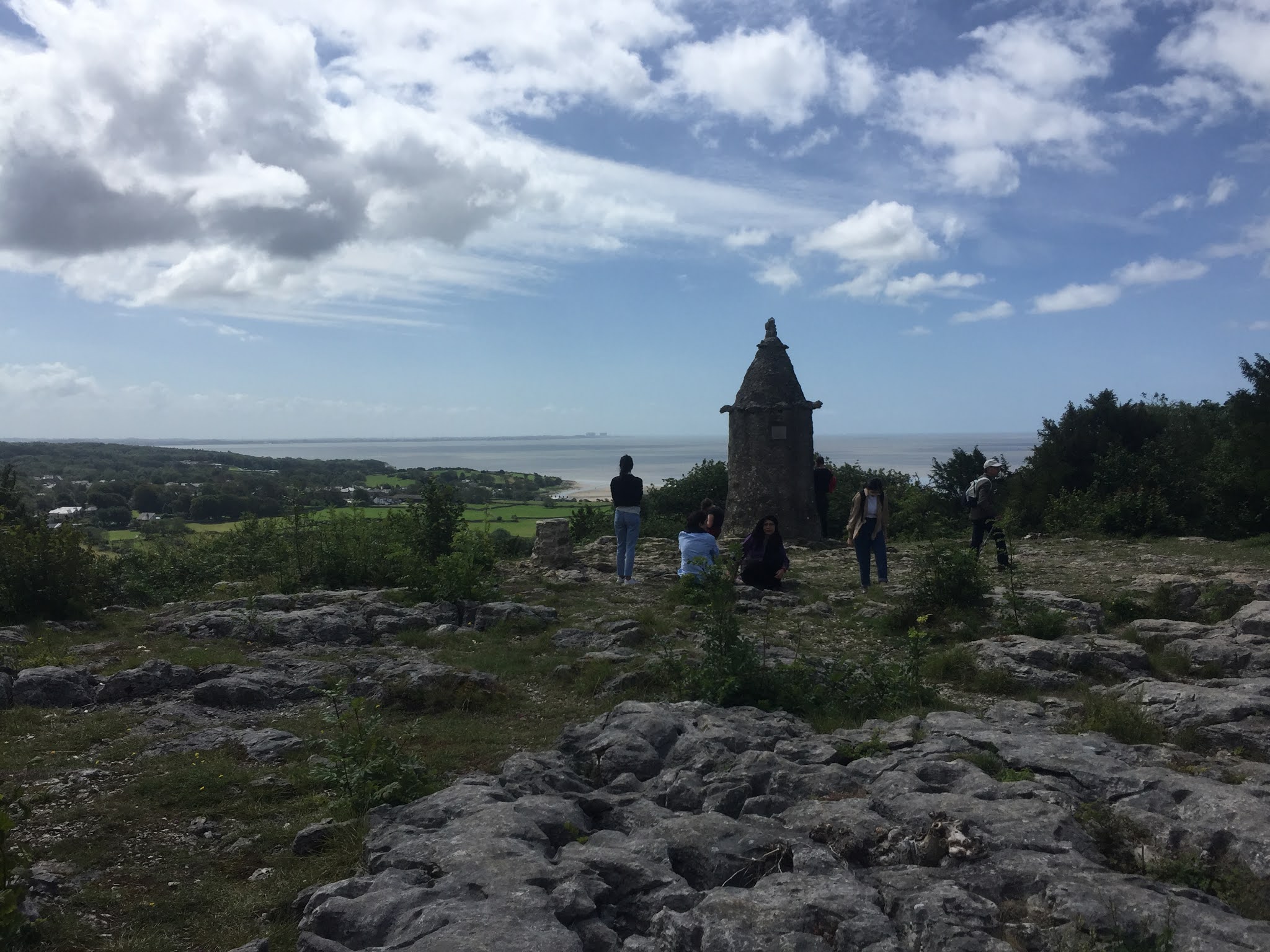
A cycle to Parlick let me meet up with Rowena and we stomped up and down the little peak 5 times as fast as we could without really running. The weather was damp but it was a joy to be out. My glute now seems fine but my ankle is still very dodgy on the rough stuff.
July was much more of a mix of cycling and running. I had 3 big days in glorious weather collecting Covid trigs. My run from Slaidburn was beautiful and I had Burn Fell and Baxton Fell almost to myself.
A short run along the old drove road led me to White Hill and the siting towers from when they built the aqueduct to carry water from Thirlmere to Manchester.
I also spotted a 'Witches' sign. I had thought these were only found near Pendle but now know there is a 50 odd mile route that the witches were taken along from Burnley to Lancaster before their trial. Another run perhaps.
From White Hill I headed north and then east to Bowland Knotts. I don't think I have ever been there in the sunshine before so I took the opportunity for some exploring (and being silly).
I decided that a loop further east around the top of the Gisburn forest was too far and so dropped south collecting another trig on my return run to Slaidburn. Back at the car I felt guilty at the missed opportunity and so after a short drive I set out again. I bagged Whelpstone Crag and Tosside with some lovely running but also some dreadful bog, felled forest edge and grass in one field that was almost as tall as me. Lots of rough ground so only about 40km in total.The weather stayed kind and I persuaded Bob he would like a mountain bike ride somewhere different. I had plans for a run on the moors above Embsay where I knew I could pick off another set of trigs.
The main paths and the area around the reservoirs and Rylstone Cross I know quite well but I had never been to Crookrise Top or to Halton Height even those this trig is only about ten minutes from the road. I had a lovely isolated run and only saw one person until the end near the car parks and reservoirs.
The one person I did see was a local game keeper and what a lovely man. He was delighted that I was using one of the small tracks he had mowed through the bog! Four more trigs in the bag. Bob enjoyed his bike ride and we made it back before the rain.
An even warmer day saw me make an extended visit to the Pendle area. Trying to pick off trigs made for an interesting route and some exploring. I had been to the little hill west of the Nick of Pendle before and started there before a big drop and climb to Black Hill and the Rigg of England.
I had never been to Stansfield Tower before and decided to ignore all the keep out signs. I felt a bit guilty but I didn't do any harm. It was a diversion out to Weets but nothing like the rough ground afterwards as I headed to a buried block near Twistleton. A friendly farmer showed me one path but lots of the area was tussocks and bog. I had seen very few people all day- although I did meet a running friend out near Weets. My last stop was the top of Pendle and it was heaving! I soon left and opted for the quieter ridges over near Mearley Clough and the Scout cairns. I was out of water and in need of an ice cream.I have had my eye on the Bay Limestone Round but was bothered about the tricky paths on Hutton Roof. I decided to reccee the second half of it- plus the extra to get back to my car. It was very worth while and another hot day. Having parked near the canal below Farleton Knott the first section was uphill. Here the running was straight forward although I did see some better lines for next time. On Hutton Roof itself I struggled in the high bracken and myriad of small woodland paths. OS maps on my phone to the rescue! This part was certainly worth checking out in advance. This was followed by some easier running and mostly downhill to Burton in Kendal before continuing west and to the Yealand area which I do not know well.
I found the rarely visited cairn on Cringlebarrow and was soon off to Warton Crag and the great views over Morecambe Bay. I found the way across the moss and was pleased to find the small hidden cairn on Heald Brow. Next stop King William Hill above Silverdale. Again some confusing paths but no big mistakes. I made a couple of small mistakes on Arnside Knott- mainly because I know it and was not concentrating on the prescribed route. At the shoreline it was crowded and I was trying to dodge all the tourists along the front and all the way to the pier. I treated myself to an ice cream and looked at the map. Heck- it was still quite a way back to the car. It would have been nice to have revisited Fairy Steps but I stuck to the fastest line I could which was quiet lanes and the old coach road to Beetham. These runs allowed me to believe I could have a go at the whole Bay Limestone Challenge and I was running out of time before we left for France. This is a 55 mile route around Morecambe Bay taking in 13 summits.
It was set up by Tom Phillips and lets runners have a new challenge and to raise money for charity. Fortunately the weather stayed warm and dry (in fact it was far too hot and I kept running out of water) and Bob said he would meet me at certain points ( i know, I don't deserve him). We drove up the evening before and parked the van at Kents Bank railway station.A quick explore showed me that the way was obvious although once the tiny concrete path ran out it was wetter underfoot than I had been led to believe. I was hoping that my epsom watch would record for long enough but had a phone with me as back up strava just in case and also for emergency navigation. Friday was even warmer as I left the van at 6.20am. The flat run along the estuary was a nice start although the recent high tide had left wet ground, mud and some hue puddles. Wet feet so early, oh well. Humphrey Head was soon in sight, it is only 1.7 miles from the station, and then I was able to turn inland and towards bigger hills. I have orienteered on Hampsfell but had to do careful navigation to actually reach the hill and even then got a total surprise when I reached the Hospice. I am sure I have never seen that before. Next was Lords seat on Whitbarrow- another orienteering area. This was a longer section of almost 8 miles and I was having to map read as I ran but things worked out well on the whole. It did stop me eating though. It was a steep pull up onto Whitbarrow but a nice run off down to Row. I made a small error here but only a few hundred metres/ a few minutes. Another longish section took me to Cunswick Scar and then I turned south.


The times don't really matter but I was chuffed. At that point I was fastest woman. I knew it wouldn't last and sure enough about 5 minutes was taken off my time a short while later. An ice cream revived me but Covid rules and online orders 24 hours in advance meant we couldn't get fish and chips. I might have another go now I know the way but it will need to be firm and dry under foot.
A great day out and well worth making a donation to CALM and Bowland Mountain Rescue (no, I didn't eat both ice creams).